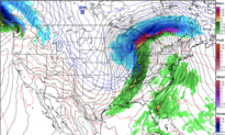

A band of extreme weather will stretch across the middle of the United States from March 15 to March 16, delivering blizzard conditions to Wisconsin and Michigan, possible tornado conditions to the Mississippi and Ohio River Valleys, and thunderstorms across the Southeast.
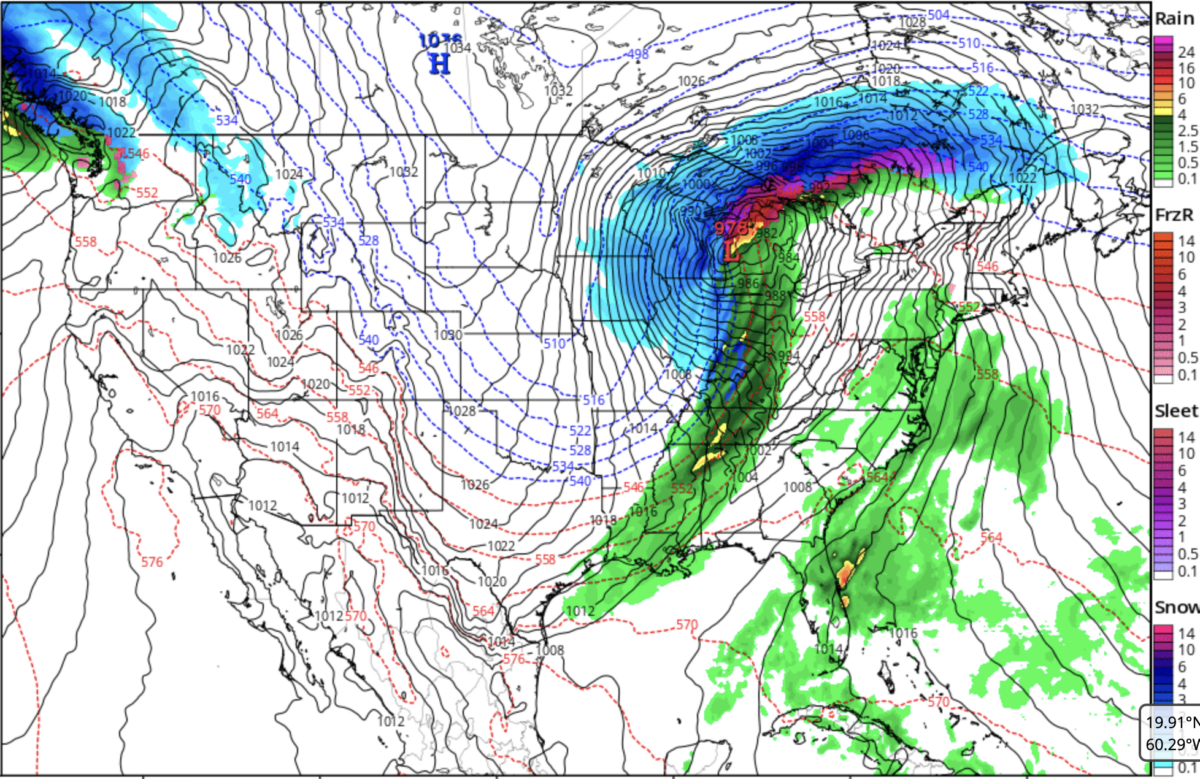
Forecast models indicated that a low-pressure cyclone would form over Iowa on the morning of March 15. It is predicted to move east across the Great Lakes toward Canada through March 16, whipping a broad band of rain across the Great Plains, Midwest, Appalachia, Deep South, and New England and forming a wall of extreme weather that stretches from Ontario to the Gulf of America.
Severe weather warnings and enhanced risks of severe thunderstorms capable of producing tornadoes were issued for a large swath of the Mississippi and lower Ohio River Valleys from Indianapolis to Shreveport, Louisiana, and included Memphis and Nashville, Tennessee. The Mississippi River and western edge of the Ohio River ran down the heart of a chunk of the United States under the enhanced risk, which also included parts of Kentucky, Illinois, Missouri, Arkansas, Mississippi, and Alabama.
“Scattered to widespread damaging winds along with tornadoes should develop on Sunday [March 15] afternoon, persisting through Sunday night across a large portion of the South-Central/Southeast States into the Midwest/Ohio Valley,” the Storm Prediction Center warned, adding that the greatest tornado and severe wind threats appear to be on the evening of March 15 in the Lower Ohio Valley and the area of the Mississippi Valley between Arkansas, Lousisiana, and Mississippi.
Some storm chasers have already announced that they were heading to the region.
Gusts in this region could exceed 75 mph, but the storms themselves were expected to move across the country at a speed of 50–60 mph, which would limit the threat of heavy rainfall and flash flooding.
Meanwhile, the National Weather Service forecasted, “Blizzard conditions appear likely across northern Wisconsin to upper Michigan through Sunday and continue into Monday as the cyclone reaches peak intensity and tracks into the Great Lakes.”
“A major winter storm is forecast to bring very heavy snow across the upper Great Lakes and upper Midwest along with widespread high winds from the northern tier states,” the National Weather Service said.
Hundreds of flights in Minneapolis and Chicago have already been canceled ahead of the storm.
By the evening of March 16, nearly the entire East Coast of the United States will face multiple inches of rain, with snowfall covering the mountains as far south as North Carolina. The area under an enhanced risk of severe, possibly tornado-triggering thunderstorms moved over North and South Carolina, Virginia, Maryland, and Delaware, and included parts of West Virginia, Pennsylvania, and New Jersey.
Philadelphia, Baltimore, Charlotte, Virginia Beach, Virginia, and Washington, D.C., were all marked to be under this enhanced risk for March 16.
The Storm Prediction Center noted, “The greatest potential for strong tornadoes and significant damaging winds appears centered on parts of South Carolina to Maryland during the late morning to afternoon.”
Some level of risk of thunderstorms covered nearly the entire East Coast, including all of Florida, as far west as Ohio, and up to Maine.
On the other side of the country, the National Weather Service stated that an atmospheric river event is tapering off over the Cascade Mountains, dumping snow on the Rocky Mountains, and “an anomalously early” heatwave would start to intensify over the Western States starting next week.
 Friends Read Free
Copy
Facebook
Tweet
Friends Read Free
Copy
Facebook
Tweet