
Flooding continues to impact North Carolina’s Outer Banks and the surrounding Mid-Atlantic coastline as Hurricane Erin begins its push away from the United States’ east coast by the morning of Aug. 21 and continues into the north Atlantic Ocean.
The National Hurricane Center reported Hurricane Erin was 260 miles east of Cape Hatteras, North Carolina, as of 11 a.m. (ET).
Its sustained winds were still at 100 mph, and a tropical storm warning remained in effect for most of the North Carolina and Virginia coastline from Beaufort Inlet, south of Cape Hatteras, through Kitty Hawk and Virginia Beach up to the Maryland state line.
North Carolina’s iconic barrier islands and Virginia remained within range of tropical storm-force winds (39 mph–73 mph) earlier on Thursday morning, but winds of up to 44 mph were still reported in Nags Head, North Carolina, by the 11 a.m. update.
Hurricane-force winds (74 mph and greater) were recorded 105 miles away from the storm’s center.
“Tropical storm conditions will continue to affect portions of the North Carolina Outer Banks and Virginia coastline for the next several hours,” the National Hurricane Center stated in its advisory update on Thursday.
“Elsewhere along the mid-Atlantic and southern New England coast, wind gusts to tropical storm force are likely through early Friday.”
Tropical Storm conditions are also expected to hit Bermuda, which sits on the eastern side of the storm.
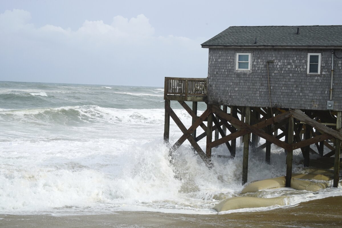
Dangerous surf conditions, rip currents, and storm surges are also expected to continue along the outer islands, causing several feet of flooding.
A large part of the Outer Banks from Cape Hatteras to Nags Head was ordered to evacuate.
The National Weather Service warned, “Storm surge flooding will also continue along the North Carolina Outer Banks through Thursday, with large waves leading to significant beach erosion and overwash, and some roads may become impassible.”
As much as four feet of storm surge is expected to wash across North Carolina’s State Road 12 between Cape Lookout and Duck.
“NC Hwy. 12 on Hatteras remains closed, but we’ve made it past this morning’s high tide,” reported Dare County, North Carolina.
“Vulnerable portions are still covered with significant water and sand—especially the north ends of Buxton and Hatteras Village.”
A state of emergency and evacuation order for Hatteras Island and all of Dare County remains in effect.
 Friends Read Free
Copy
Facebook
Tweet
Friends Read Free
Copy
Facebook
Tweet