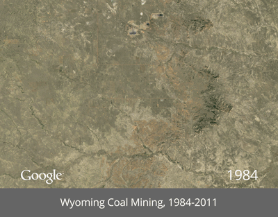
Google Earth timelapse: Google, NASA, TIME, and the U.S. Geological Survey teamed up to create timelapses of more than 25 years of images taken from space.
“We believe this is the most comprehensive picture of our changing planet ever made available to the public,” said Google in a blog post.
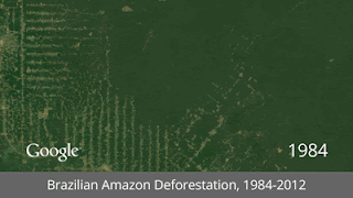

The images were collected as part of a mission between the Geological Survey and NASA, through satellites since the 1970s.
Google sifted through more than two million images to find the highest-quality pixels (those without clouds) for every year since 1984 and for every spot on Earth.
More timelapses are available on Google’s Google+ profile.
 Friends Read Free
Copy
Facebook
Tweet
Friends Read Free
Copy
Facebook
Tweet