Commentary
China is conducting a large-scale effort to map and monitor the ocean floor across the Pacific, Indian, and Arctic oceans, gathering data that naval experts say would be critical in a future submarine war with the United States and its allies.
The operation involves 42 research vessels tracked over a five-year period and hundreds of sensors collecting information on underwater terrain, temperature, salinity, and currents, all of which affect submarine movement and detection. At least eight of the vessels have conducted seabed mapping, while another 10 have carried mapping equipment, according to a review of Chinese state media, university vessel descriptions, and government statements.
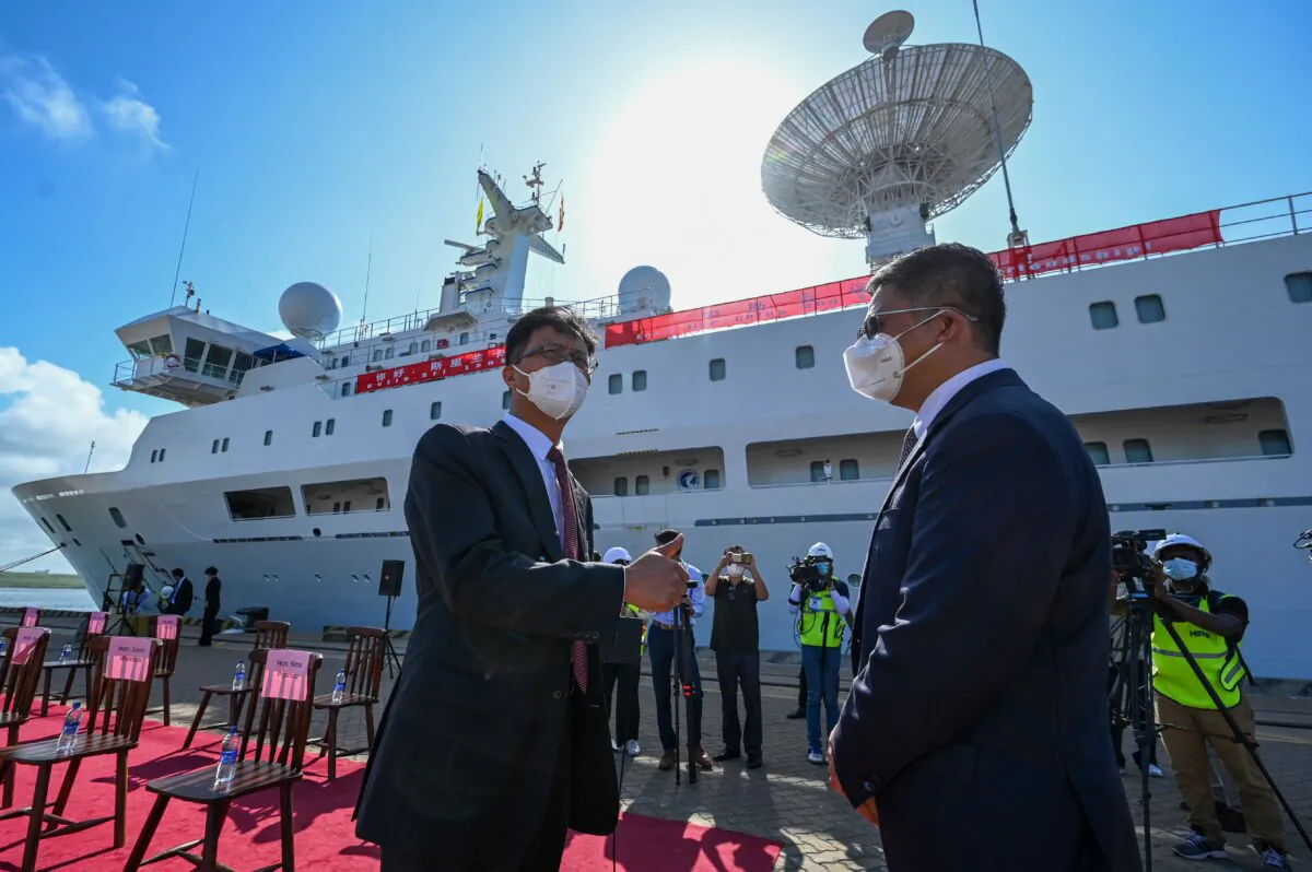
Although China describes much of the activity as scientific research, the data have direct military applications. The Dong Fang Hong 3, operated by Ocean University of China, spent 2024 and 2025 operating near Taiwan, Guam, and key Indian Ocean routes. In October 2024, it checked on Chinese ocean sensors capable of identifying undersea objects near Japan, and in March 2025, it crisscrossed waters between Sri Lanka and Indonesia, covering approaches to the Malacca Strait. The university described the work as mud surveys and climate research, but a scientific paper co-written by Ocean University academics shows that it also conducted deep-sea mapping.
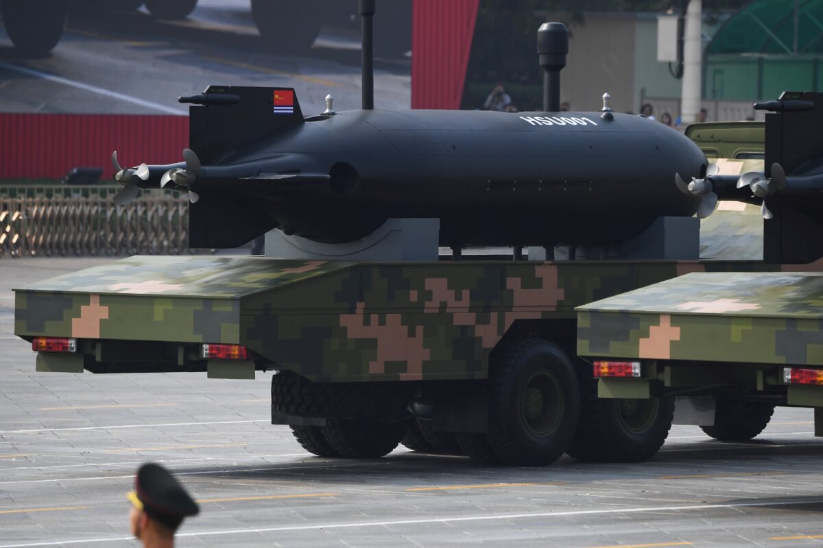
China’s civilian survey ships sometimes disable their tracking systems, meaning that the full scope of the campaign may be larger than what ship-tracking data can determine. Beyond surface research vessels, China is using unmanned underwater vehicles (UUVs) to accelerate and extend the mapping effort. The HSU-001, a large-displacement UUV first publicly revealed in 2019, is equipped with side-scanning sonar arrays and a magnetic anomaly detector, enabling it to map the ocean floor and detect undersea objects without requiring a surface ship overhead.
Chinese underwater gliders have conducted surveillance missions lasting more than 140 days across thousands of miles, including operations in the South China Sea and Indian Ocean. At the September 2025 military parade in Beijing, China unveiled two new extra-large UUV models, with analysts noting that their modular design allows launch from multiple ship types or shore facilities, complicating adversary tracking before deployment.
The research supports the People’s Liberation Army Navy’s undersea warfare capabilities, as commanders rely on detailed knowledge of underwater terrain to avoid collisions, conceal their vessels, and detect submarines. Submarines are typically identified by the sounds they emit or by sonar echoes, and the movement of those sound waves varies with the underwater landscape, as well as with water temperature, salinity, and currents.
By building a detailed picture of these conditions across the Pacific and Indian oceans, China can predict where U.S. submarines are most likely to operate, improve the accuracy of its sonar systems, and position seabed sensors to cue surface and airborne anti-submarine warfare assets.
The effort reflects the Chinese regime’s broader strategy of civil-military fusion, in which civilian scientific research is integrated with military development. A key component is the “transparent ocean” initiative, which uses networks of seabed sensors and buoys to provide real-time data on underwater conditions. China’s undersea sensor network is made up of five interconnected layers stretching from the seabed upward, integrating air, surface, seabed, and undersea sensors into a networked architecture.
The mapping program is most directly tied to the regime’s effort to protect its ballistic missile submarines. China’s six Type 094 Jin-class submarines are based at Yulin Naval Base on Hainan Island and conduct patrols primarily within the South China Sea, which Beijing treats as a protected nuclear bastion.
Because the Type 094 generates more acoustic noise than U.S. or Russian equivalents, China relies on layered defenses, fortified islands, air cover, surface patrols, and seabed sensors to shield the submarines from detection. By mapping the South China Sea and broader Indo-Pacific in detail, China reduces the ability of U.S. attack submarines to track its ballistic missile submarines while simultaneously building the data needed to hunt U.S. and allied submarines in any future conflict.
The survey focuses on the first island chain, Guam, Hawaii, the Malacca Strait, the Indian Ocean, and the Arctic, reflecting Beijing’s ambition to develop a blue-water navy and to close the knowledge gap that has long given the U.S. Navy an advantage in undersea warfare.
China already fields more than 60 submarines overall, including Shang III nuclear-guided missile submarines equipped with a 24-cell vertical launch system, and U.S. naval intelligence assessments indicate that China could expand that fleet to approximately 70 submarines by 2027 and 80 by 2035, alongside parallel investments in additional UUVs and seabed sensor networks.
In testimony to a congressional commission in March, Rear Adm. Mike Brookes, commander of the U.S. Office of Naval Intelligence, said that China had dramatically expanded its surveying efforts, providing data that enable “submarine navigation, concealment, and positioning of seabed sensors or weapons,” and that potential military intelligence collection by Chinese research vessels “represents a strategic concern.”
To counter China’s expanding submarine capabilities, in 2023, the United States launched its largest overhaul of the integrated undersea surveillance system since the 1950s. As part of that effort, it is retrofitting surveillance ships with updated sensors and subsea microphones to improve detection of submarines and UUVs, while procuring seven new TAGOS-25 Explorer-class ocean surveillance ships to replace aging vessels.
The Trump administration reaffirmed its support for the trilateral security agreement between Australia, the UK, and the United States, known as AUKUS, in December 2025, following a review led by Undersecretary of War Elbridge Colby, and maintained plans to rotationally deploy U.S. and UK submarines from HMAS Stirling in Western Australia as early as 2027. The agreement also includes the sale of three to five Virginia-class submarines to Australia beginning in the early 2030s, with Canberra investing $3 billion into the U.S. submarine industrial base to accelerate production.
Beyond AUKUS, the United States has strengthened cooperation with India, expanding joint P-8 Poseidon maritime patrol operations in the Indian Ocean. In February 2025, U.S. President Donald Trump and Indian Prime Minister Narendra Modi agreed to India’s purchase of six additional P-8I aircraft, further enhancing anti-submarine warfare coverage. These efforts align with the 2026 national defense strategy, released on Jan. 23, which identifies deterring China in the Indo-Pacific as the second strategic priority after homeland defense.
Views expressed in this article are the opinions of the author and do not necessarily reflect the views of The Epoch Times.
 Friends Read Free
Copy
Facebook
Tweet
Friends Read Free
Copy
Facebook
Tweet