Commentary
Toronto’s Yonge Street was once fabled as the longest street in the world. Though that boast is not now considered accurate by the Guinness Book of World Records (the title may actually be held by the city’s Bathurst Street), Yonge Street has a long and fascinating history.
For thousands of years, indigenous tribes created a series of trails that would connect Lake Ontario to the interior. The most important of these was the “Toronto Carrying Place,” a portage route running 45 kilometres from the Humber River on Lake Ontario to the Holland River near Lake Simcoe, and then onward via the Severn River system to Georgian Bay. The Huron-Wendat, Haudenosaunee, and later the Mississauga peoples used these paths for war, trade, diplomacy, and seasonal movement.
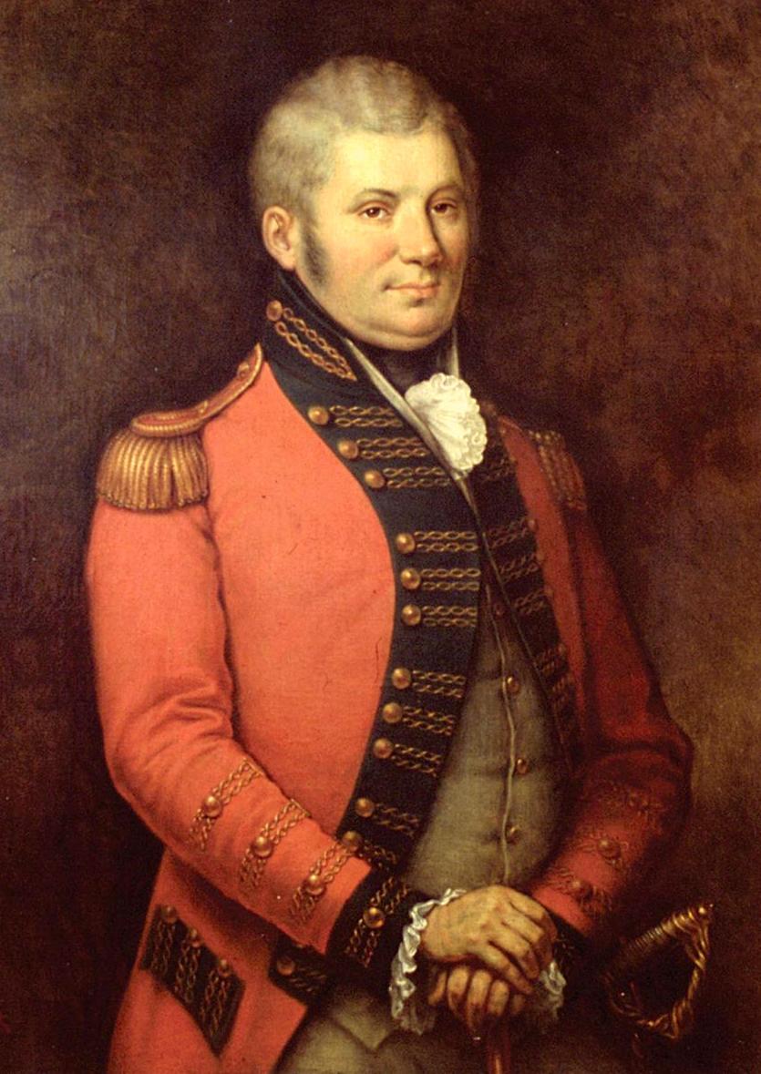
When the British claimed the area as Upper Canada they realized the strategic importance of this route, particularly in light of tense relations with the new and unfriendly United States. John Graves Simcoe, the lieutenant-governor in 1793, saw that the current capital at Newark (now Niagara-on-the-Lake) was too exposed to American attack and that there was a need for a route that would allow British forces to move securely between Lake Ontario and the upper Great Lakes. His solution was to move the capital to the village of York and create a military road that would connect that town to Lake Simcoe, from which troops and supplies could move by water to Georgian Bay and beyond. This would suit the needs of the army and provide an entry to the interior lands that would encourage settlement by Loyalists and British immigrants.
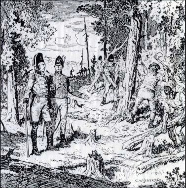
Simcoe used indigenous scouts and their knowledge of paths such as the “Carrying Place” to plan the course of the road that he would eventually name after his friend (and expert on Roman roads) Sir George Yonge. In September 1793, Simcoe, his native guides, and some soldiers headed north and identified the contours of the proposed path and places for suitable fortification and settlement.
In 1794, the colony’s Deputy Surveyor General, Augustus Jones, was made responsible for blazing a narrow trail through bush, forest, and swamp, setting out the way that labourers and troops of the Queen’s Rangers could follow to create a road suitable for wagon travel. He was assisted in this by Wahbanosay, the leader of the Mississauga people of the area, and in 1796 Jones (polygamously) married Whabanosay’s daughter Tuhbenahneequay.
Construction in the late 1790s proceeded in stages and often under difficult conditions. Simcoe initiated work by granting land along the projected line to settlers on condition that they clear a specified frontage—typically 10 metres—through their lots, effectively outsourcing road-building to would-be farmers who had to hack through dense forest and wet ground to bring their land into cultivation. In 1794, before the road was fully driven, the Bavarian artist and architect William von Moll Berczy of the German Land Company led a group of some 186 settlers to establish German Mills in what is now Markham. They cleared 25 kilometres of Yonge Street.
By 1799, Yonge Street extended from York to Holland Landing, reaching the Holland River and completing the intended overland link between Lake Ontario and the Lake Simcoe system, but it remained a rough, often muddy track. Contemporary descriptions referred to parts of it as “a sorry bog.”
The Upper Canada Gazette noted that local officials, among whom numbered Chief Justice John Elmsley, met in December 1800 to complain that Yonge needed improvement so farmers and traders could actually get goods to market, implying a road frequently impassable or at least deeply rutted. The newspaper hoped that such improvements might attract the attention of the North West Company and lead it to set up a fur trade depot. Even decades later, during the 1820s and early 1830s, much of Yonge north from York was still a dirt road through forest, difficult for farmers’ loaded wagons, particularly in wet seasons.
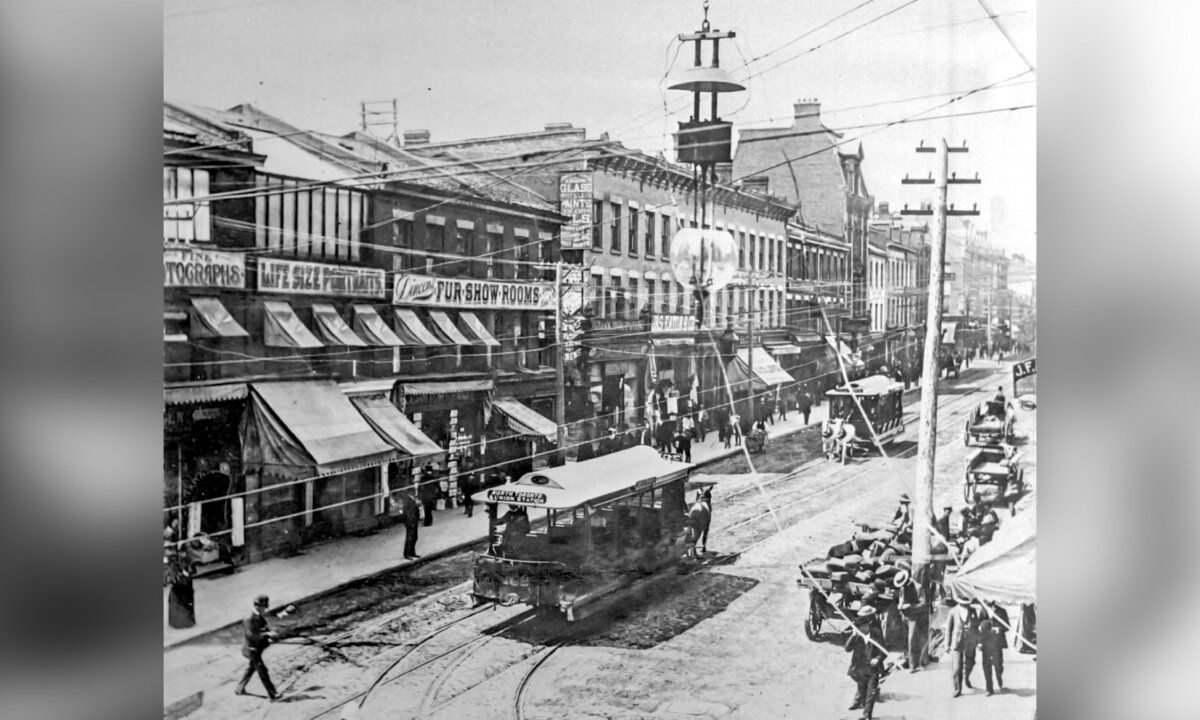
Despite its primitive state, Yonge Street quickly became a magnet for settlement that shaped the social geography of early Upper Canada. The road also attracted religious and communal settlements such as the Yonge Street Quaker community, which grew into one of the largest concentrations of the Society of Friends in Upper Canada in the early 19th century. Villages like Yorkville, first laid out in the 1830s just north of York, developed along Yonge as waystations and service centres for the rural hinterland, eventually becoming absorbed into Toronto.
Views expressed in this article are the opinions of the author and do not necessarily reflect the views of The Epoch Times.