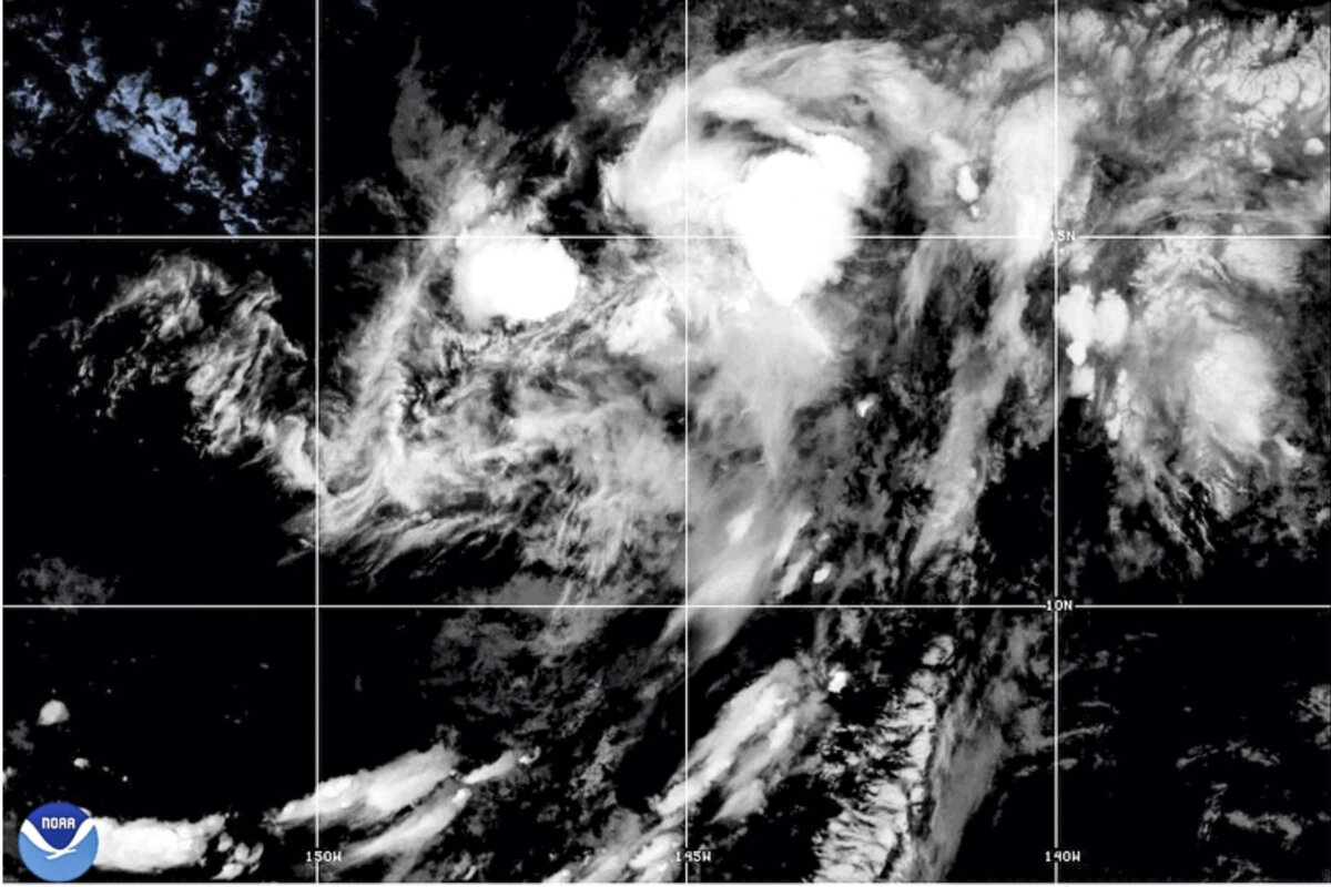

A hurricane watch has been issued for the Big Island of Hawaii as Tropical Storm Lala forms over the Pacific Ocean on Aug. 13.
The National Hurricane Center predicts the storm will bring rain, high winds, and dangerous surf to the Hawaiian Islands starting late on Friday.
The storm’s showers extend hundreds of miles from southwest to northeast, with some rotation as of Thursday evening.
Meteorologists for AccuWeather predicted that Lala could bring up to two feet of rain to Hawaii over the weekend, and could reach hurricane strength. Wind gusts and mudslides are also possible, with the possibility of winds reaching up to 85 miles per hour.
The weather service also reports that conditions along Lala’s projected track allow for some strengthening of the storm, due to warm waters in the area.
However, the exact track of the storm will depend on where the center of the storm takes shape. If it organizes south, the storm could shift south as well.
“One close comparison storm to the current situation in Hawaii was Hurricane Hone in August of 2024,” AccuWeather lead hurricane expert Alex DaSilva said. “Hone went just south of the Big Island but still brought 70-mph winds and 2 feet of rain.”
So far, a hurricane has never made landfall on the Big Island, and only two tropical storms have ever done so. Tropical Storm Iselle made landfall in 2014, and Darby followed suit in 2016.
The Federal Emergency Management Agency urged residents to prepare now for Tropical Storm Lala. “Impacts could begin tomorrow and continue through the weekend,” the agency said in a social media post.
“Stay safe & know your risk, make a plan, have multiple ways to receive alerts, charge your devices & follow instructions from local officials.”
East of Lala’s current position, Tropical Storm Hernan formed on Aug. 13, and is projected to continue it’s move across the Pacific Ocean, as it loses wind intensity over the weekend. Hernan isn’t expected to threaten land.
Hurricane threats are limited by ocean temperatures, atmospheric wind patterns, and wind shear. Additionally, Hawaii’s rugged terrain disrupts major storms that move over the Island.
As of Aug. 11, the eastern Pacific has produced seven named storms, two of which were hurricanes. Genevieve, in late July, was the strongest of the pair, reaching Category 5 intensity and maximum sustained winds of 160 mph. However, storms continue to form as the season progresses.
Genevieve was over 500 miles south-southwest of the southern tip of Baja California when it reached that status.
The storm was the first of its size to appear in the eastern Pacific since Hurricane Kristy in October 2024, and had maximum sustained winds of around 160 mph.
T.J. Muscaro contributed to this report.
 Friends Read Free
Copy
Facebook
Tweet
Friends Read Free
Copy
Facebook
Tweet