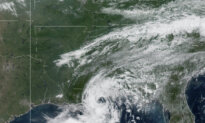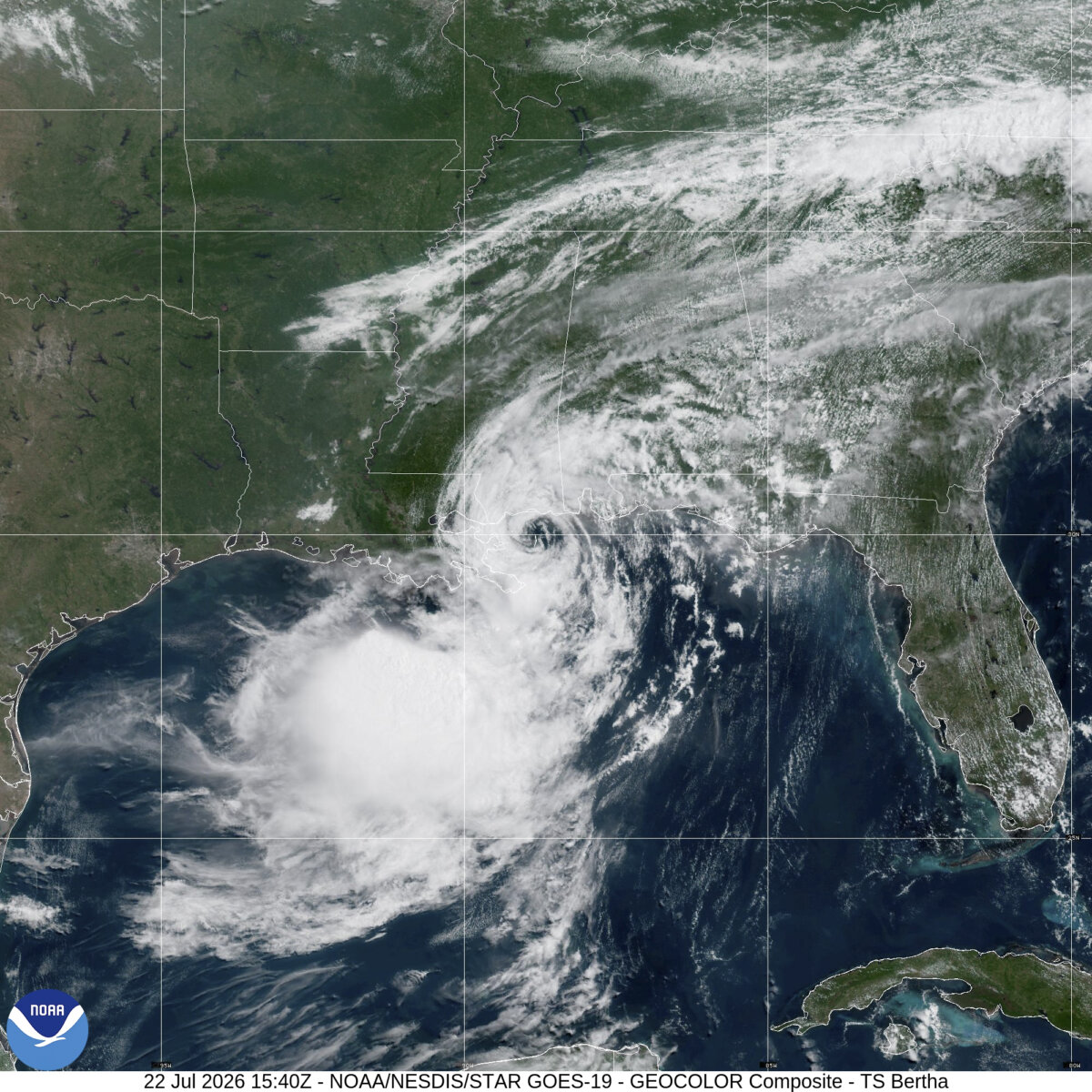

Tropical Storm Bertha moved over the coast of Louisiana in the early afternoon of July 22 in St. Bernard Parish, near the Biloxi Wildlife Management Area, approximately 40 miles east of New Orleans.
The National Hurricane Center (NHC) reported that the storm’s center made landfall around 2 p.m. CT, its maximum sustained winds were 45 mph, and it was moving west-northwest at a speed of 7 mph.
As of the morning of July 22, the second named storm of the 2026 hurricane season retained its 50 mph maximum sustained wind speed.
Its center was clocked 55 miles north-northeast of the mouth of the Mississippi River and about 40 miles south of Pascagoula, Mississippi.
However, tropical storm winds (sustained winds 39 mph–73 mph) extended 105 miles from the center.
A tropical storm warning remains in effect for a vast swath of the Gulf Coast from Florida’s Okaloosa–Walton County line to Morgan City, Louisiana.
That includes cities such as Pensacola, Mobile, Biloxi, and Gulfport.
Metropolitan New Orleans and Lake Pontchartrain are also under a warning.
The National Hurricane Center said that Bertha was “wobbling” in a west-northwest direction at six mph, with the expectation that it would pick up speed.
It predicted, “The center of Bertha will move near or along the Louisiana and upper Texas coasts through Thursday [July 23], and then move farther inland into Texas on Friday.”
A tropical storm watch remains in effect for Lake Maurepas and the stretch of the Gulf Coast West of Morgan City, Louisiana, to Sargent, Texas.
This includes Galveston, Texas City, and Lake Jackson.
Bertha’s center was expected to reach the Brazos River between Houston and Angleton by 7 p.m. CT on July 23.
By 7 p.m. CT on July 22, Bertha’s center was 40 miles southwest of New Orleans and 165 miles east-southeast of Lake Charles. Maximum sustained winds were holding at 45 mph, and tropical storm warnings were still in effect from the Alabama/Florida state line to Cameron, Louisiana.
Tropical Storm-force winds exceeded 160 miles from its center.
Little change in the storm’s strength is expected over the next 24 hours, but it is expected to dissipate inland over Texas by July 24.
Expected effects of the cyclone include a storm surge of one to three feet for coastal areas, with most of eastern Louisiana from the mouth of the Mississippi River to the Mississippi–Alabama state line told to expect two to four feet.
“The deepest water will occur along the immediate coast,” the hurricane center stated in its advisory. “Surge-related flooding depends on the relative timing of the surge and the tidal cycle, and can vary greatly over short distances.”
Bertha’s counterclockwise rotation is also expected to continue delivering life-threatening surf conditions and rip currents along Gulf Coast beaches.
In terms of rainfall, the NHC anticipates one to four inches of rain with isolated incidents of up to six inches that could cause flash flooding in urban areas.
Louisiana Gov. Jeff Landry signed an emergency declaration and held a mid-afternoon press conference to address his state’s citizens on the storm preparations as the storm made landfall.
He said that his administration had been working with local water boards since July 19 to prepare for the worst-case flooding scenario, ensuring that all of the pumps in and around New Orleans were manned and working.
“We have taken the storm seriously from the beginning, and that’s what we all should do every time a storm threatens, a storm system threatens our state,” he said.
“The good news is that the storm is likely not to produce the type of rainfall or wind event that it could have. But I want to remind everyone of something important: that forecasts can change.
“A weaker storm can produce dangerous rainfall, localized flooding, and hazardous travel conditions,” he added.
Climatologist Jay Grymes shared a summary of that forecast, which indicated that the main energy of the storm was staying more than 140 miles off the coast, and a combination of dry air, wind shear, and interaction with land would cause Bertha to weaken as it passes through the state.
However, pockets of heavy rain capable of producing flooding were still possible in some areas, and Bertha’s center may continue on to Texas, its bands still stretched back to the Florida Panhandle, so residents should still prepare for more stormy days ahead.
Grymes described the storm as a preseason football game in relation to the overall length and intensity of hurricane season.
Landry agreed with that comparison and saw this storm as a great “dry fire test” for the state’s emergency preparations.
The governor said Brigadier General Jason P. Mahfouz, Army Assistant Adjutant General of Louisiana’s National Guard, would be able to report in 24 hours on the status of all the levee boards, and sewage and water boards.
“That’s exactly how government should operate: preparing for a storm before the storm gets there, and not having to react once danger basically is upon us, or the worst-case scenario comes to pass.
“You know this is something that I expect every level of government to stay focused on, and that’s its core responsibility of protecting people and maintaining the critical infrastructure that protects our communities, and to be ready to respond if conditions change,” he said.
Landry also directed residents to an online resource center and urged them to stay prepared and to get regular updates on the storm’s development.
 Friends Read Free
Copy
Facebook
Tweet
Friends Read Free
Copy
Facebook
Tweet