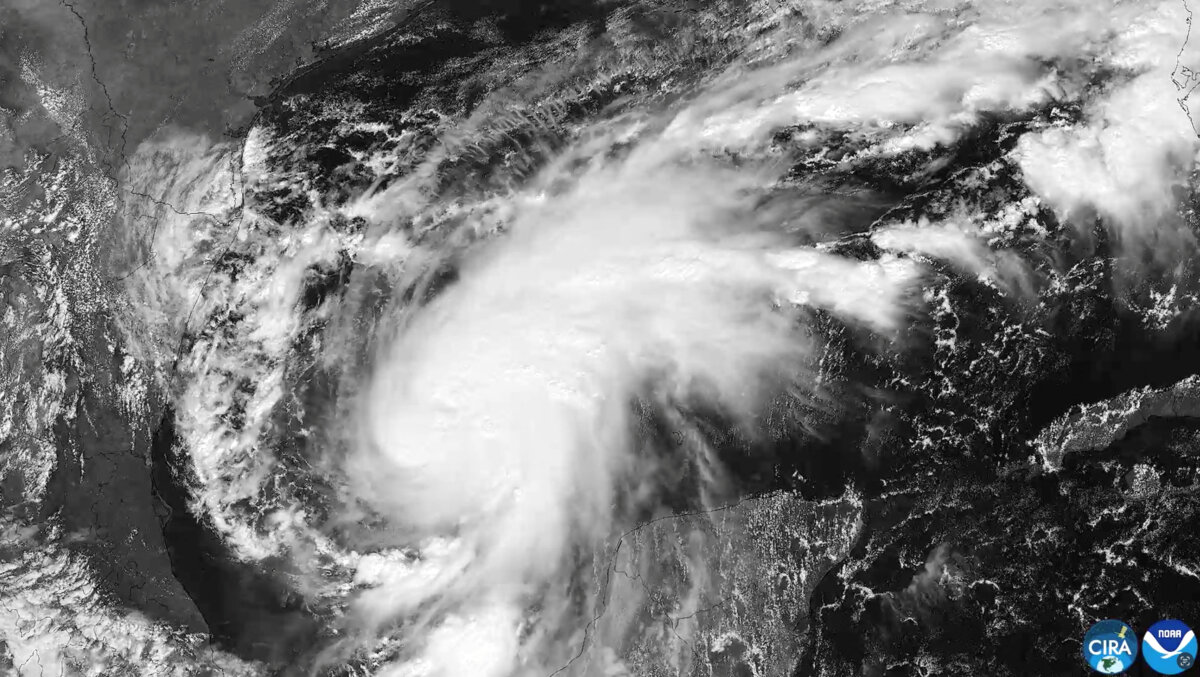

After 130 days of relative calm, the 2026 Atlantic hurricane season birthed its first hurricane, and it’s headed for the Gulf Coast.
Hurricane Isaias officially evolved from a tropical storm late Wednesday, according to the National Hurricane Center, setting a new record for the quietest start to a hurricane season since the satellite era began 60 years ago.
It also nearly ties an Oct. 8 record for the latest first hurricane of the Atlantic season that has stood for more than 100 years.
Isaias is about 460 miles south-southwest of the mouth of the Mississippi River, with maximum sustained winds of 75 mph with higher gusts, according to NHC’s 10:30 p.m. CT advisory.
A hurricane watch was triggered for a swathe of the Gulf Coast from Indian Pass, Florida, to Bay St. Louis, Mississippi, on the morning of Oct. 7.
Areas further west to the Jefferson/Plaquemines Parish line in Louisiana and further east to the Aucilla River were put under a tropical storm watch.
Just a few hours after becoming a Tropical Storm, Isaias was forecast to deliver considerable storm surge to its projected landing area—with five to seven feet expected in and around the Mobile Bay Area.
That means five to seven feet above normal high tide levels. A storm surge watch stretches from the Mouth of the Mississippi River to Yankeetown, Florida.
Dauphin Island, along Alabama’s Gulf Coast, already began receiving tidal flooding on Oct. 7.
Tropical storm-force winds are expected to arrive onshore by the morning of Oct. 9.
Rainfall throughout the event is expected to be more than six inches across the region from Southeastern Louisiana through the Florida Panhandle, with isolated areas of 10 inches.
The National Hurricane Center warns that as the rainbands make their way inland, the chance of tornadoes also increases, with a potential risk looming from the evening of Oct. 9 through Oct. 10.
Florida Gov. Ron DeSantis declared a state of emergency for several counties along the Panhandle, which deploys the state emergency agency “to stage critical preparedness resources and ensure Florida is ready to respond.”
Those counties are: Baker, Bay, Calhoun, Columbia, Dixie, Escambia, Franklin, Gadsden, Gilchrist, Gulf, Hamilton, Holmes, Jackson, Jefferson, Lafayette, Leon, Liberty, Madison, Okaloosa, Santa Rosa, Suwannee, Taylor, Walton, Wakulla, and Washington.
“We are preparing for Isaias to make landfall in the Mobile-Pensacola region as a Category 3, which is a major hurricane,” DeSantis said in a post on X on Oct. 7.
“The ‘dirty’ side of the storm is the east side, which is projected to be large. Will mean impacts across the Panhandle.”
When commenters noted that Isaias was expected to be a Category 2 hurricane at landfall, the governor said, “Better to prepare for a Category 3 and end up with a weaker storm than to assume a weaker storm and get hit with a three. … It would be great if wind shear weakens it, but it might not.”
Several of those counties preemptively canceled school on Oct. 9, including Baldwin County, Santa Rosa County, Okaloosa County, and Escambia County, which includes Pensacola.
Nearby along the Florida Panhandle, Destin–Fort Walton Beach Airport announced it would shut down operations ahead of the storm at 9 p.m. local time on Oct. 8.
Emergency Management agencies in Alabama and Mississippi also issued warnings to their residents, advising them to take action immediately to prepare for the incoming storm.
The Atlantic Basin includes the Atlantic Ocean, Sargasso Sea, Caribbean Sea, and the Gulf of America. Its hurricane season begins on June 1 and ends on Nov. 30.
The 2026 season so far has seen a record-setting calm start.
It is the first time since 1914 that no hurricane has formed in the Atlantic until now, and 1914 is one of only two years on record that saw no Atlantic hurricanes. The other year was 1907.
Jack Phillips contributed to this report.
 Friends Read Free
Copy
Facebook
Tweet
Friends Read Free
Copy
Facebook
Tweet