
Tropical Storm Edouard is forecast to strengthen before reaching the northwestern Gulf Coast and may strengthen into a hurricane before then, according to an update posted by the National Hurricane Center (NHC) on Tuesday morning.
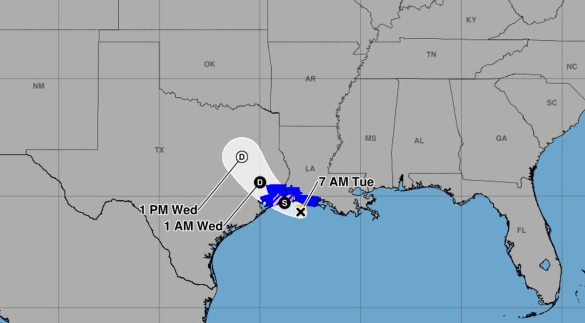
A tropical storm warning is in effect from Port Bolivar, Texas, to the Vermilion and Iberia parish line, the NHC said.
A storm surge warning is currently in effect for a region extending from High Island, Texas, to the Vermilion and Cameron parish line in Louisiana, the NHC said in an 8 a.m. ET update.
A hurricane watch was issued for the area stretching from High Island, Texas, to Cameron, Louisiana.
A tropical storm watch is when tropical storm winds of 39 to 73 mph are expected within the next 48 hours, while a warning is issued when tropical storm winds are expected within 36 hours, the NHC said.
A hurricane warning is issued when sustained winds of 74 mph or higher are expected within 36 hours or less, while a watch is issued by the NHC when the threat could occur within 48 hours. A storm surge warning is when life-threatening tidal inundation is possible within 36 hours.
According to the agency, the storm is 40 miles south-southeast of Cameron and 110 miles east-southeast of Port Arthur, Texas, and currently has maximum sustained winds of 40 mph. The storm is moving west-northwest at 8 mph as of 8 a.m. ET.
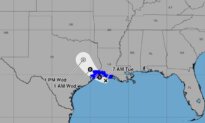
Landfall will likely occur close to the Louisiana–Texas state line around midday on Tuesday, according to a forecast map. The system was officially designated as Tropical Storm Arthur on the evening of Aug. 31.
While Edouard is a tropical storm, the NHC forecasted “significant strengthening” before it nears the northwestern Gulf Coast on Tuesday.
Separately, an NHC forecast discussion stated that the “intensity forecast today is problematic” as “Edouard has managed to develop a small core that could be prone to rapid changes in intensity.”
“In addition, environmental conditions are quite favorable for intensification while Edouard remains over water,” the agency said.
Forecasters expect Edouard to bring heavy rain to the region from Tuesday evening into Wednesday morning, potentially leading to flash flooding, according to the NHC.
The Galveston Independent School District announced that it canceled classes on Tuesday ahead of the storm making landfall in the state.
“This is our first big storm of the season, and I’ll tell you, Texas is prepared,” Orlando Alanis, assistant agency director and chief of state operations and incident support of the Texas Division of Emergency Management, said during a news conference.
In the Pacific Ocean on Tuesday, Tropical Storm Lowell was roughly 600 miles southeast of Hilo, Hawaii, with maximum sustained winds of 70 mph while moving west at 10 mph. Forecasters said Lowell could rapidly intensify and become a hurricane by Wednesday.
Also in the Pacific, Tropical Storm Marie formed early Tuesday well offshore of southwest Mexico and wasn’t threatening land, the center said.
The storm was about 470 miles southwest of Manzanillo, with maximum sustained winds of 45 mph, and was moving northwest. Marie was expected to become a hurricane in the coming days.
Elsewhere in the Pacific, Karina became a hurricane on Sunday, fueled by warm waters far from shore, and strengthened on Monday into a powerful Category 4 storm. But it did not threaten land, forecasters said.
The Associated Press contributed to this report.
 Friends Read Free
Copy
Facebook
Tweet
Friends Read Free
Copy
Facebook
Tweet